GIS is acknowledged and promoted by The BNGIS Centre as a practical solution for creating, displaying and interpreting coastal state claims by The Bahamas as well as investigating neighboring countries claims to the sea. In 2005 - Ministry of Foreign Affairs requested technical assistance from the BNGIS Centre in order to meet obligations to United Nations Convention on Laws of The Sea (UNCLOS) to which The Bahamas is signatory. In 2008 and beyond emphasis was placed on advancing submissions to the United Nations, chief of which was the establishment of the country’s maritime baselines.

BNGIS Centre’s members of the delegation for the resumption of talks with the Republic of Cuba right:
Ms. Antonique Sweeting, GIS specialist & trainer, BNGIS Centre and Ms. Carolann Albury, Director, BNGIS Centre.
BNGIS Centre’s technical assistance to the Ministry included but was not limited to:
- Investigating use of modern technologies to produce Archipelagic baseline for The Bahamas.
- Procurement of Carislots Software and training conducted initially by Carislots consultant in 2005 with all subsequent training conducted by the Centre.
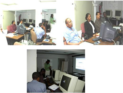
- Series of Executive Work Sessions led by the Ministry of Foreign Affairs and Executives on the Delimitation Committee with the BNGIS Centre performing complex scenario based calculations utilizing Carislots Software.
- Refresher training course in Carislots conducted by the BNGIS Centre.
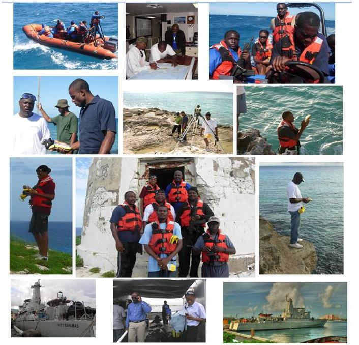
- Series of Field Verification Patrols with BNGIS Centre as lead data collector in collaboration with the Royal Bahamas Defense Force and the Department of Marine Resources.
- Production of Baseline Maps for the Commonwealth of The Bahamas and generation of baseline geographic coordinates.
- Preliminary claim to the Outer Limits of The Continental Shelf and Beyond 200nm.
- Conduct complex analysis based on technical needs articulated by Dr. Saunders, Advisor to the Ministry of Foreign Affairs.
- Preparation of maps and associated documentation for the resumption of talks with the Republic of Cuba.
As a result of the work of the Delimitation Committee, on the 11 December 2008, The Commonwealth of The Bahamas deposited with the Secretary- General, pursuant to article 47, paragraph 9, of the Convention, a list of geographical coordinates of points defining the archipelagic baselines, as contained in the Archipelagic Waters and Maritime Jurisdiction (Archipelagic Baselines) Order, 2008 (Order S.I. No. 107 of 2008) issued under section 3(2) of the Archipelagic Waters and Maritime Jurisdiction Act, 1993, accompanied by an illustrative map.
For more information follow the link:
http://www.un.org/Depts/los/LEGISLATIONANDTREATIES/PDFFILES/mzn_s/mzn65.pdf
Additionally under Article 76 of the United Nations Convention on Law of the Sea (UNCLOS) the Commonwealth of The Bahamas deposited its preliminary claim to the Outer Limits of The Continental Shelf and beyond 200nm.
For more information follow the link:
http://www.un.org/depts/los/clcs_new/commission_preliminary.htm
Bahamas Delegation Meet with Officials from The Republic of Cuba
Havana, Cuba

Bahamas Delegation Meet with Officials from The Republic of Cuba
New Providence, Bahamas

List of Delegates to Meet with The Republic of Cuba
Head of Delegation
Ambassador Joshua Sears
Director General
Ministry of Foreign Affairs
Delegates
Ms. Camille Johnson
Permanent Secretary
Ministry of Health
H. E. Mr. Vernon Burrows
Ambassador
Embassy of The Commonwealth of The Bahamas
Ambassador Carlton Wright
Head of the Technical Training Division
Ministry of Foreign Affairs
Captain Godfrey Rolle
RBDF/Chair
Bahamas Delimitation Committee
Mr. Michael Braynen
Director of Marine Resources
Ministry of Agriculture and Marine Resources
Lt. Cdr. Loren Klein
RBDF, Senior Counsel
Office of The Attorney General
Ms. Carolann Albury
Director
Bahamas National Geographic Information Systems (BNGIS) Centre
Cdr. Samuel Evans
Royal Bahamas Defence Force
Ms. Odecca Gibson
Counsel/Legal Adviser
Ministry of Foreign Affairs
Mr. Gilles Deal
Energy Officer
Ministry of The Environment
Ms. Natasha Turnquest
Assistant Secretary
Ministry of Foreign Affairs
Mr. Nestor Sands
Third Secretary/Vice Consul
Embassy of The United States of America
Ms. Antonique Sweeting
GIS Specialist
Bahamas National Geographic Information Systems (BNGIS) Centre
Ms. Krissy Hanna
Third Secretary/Vice Consul
Embassy of the Bahamas
Ms. Kimberly Lam
Foreign Service Officer
Ministry of Foreign Affairs
Adviser
Professor Phillip Saunders
Consultant
Ministry of Foreign Affairs
Maritime Boundary Field Verification
BNGIS Centre, Royal Bahamas Defense Force, Department of Marine Resources carried out baseline field verification missions in Abaco, Mayaguana, Inagua & Cay Sal

Initial Support (2006) Continuation of Assistance Associated with UNCLOS Article 46
At the request of Mr. George Stewart, Consultant attached to the Ministry of Foreign Affairs, the BNGIS organized a customized work session for the delimitation of the Bahamas baselines. Technical tasks undertaken included plotting baselines, performing area calculations (water to land ratios) and generating median line between Bahamas and Cuba.

Refresher Training Course in CARISLOTS Software
Recognizing the need the resumption of maritime boundary delimitation talks and the crucial contributions of the Centre, The Ministry of Foreign Affairs (July 2007) requested training refresher course in Carislots software. Training Sessions were conducted by Ms. Sweeting, GIS Analyst and Trainer.

